|
The objective of the study is to mitigate flood in Cavite Lowland Area in the Province of Cavite through the formulation of a flood mitigation master plan for the three river basins, a feasibility study for priority projects selected in the master plan, and development of flood management capacity for counterpart organizations.
SRDP provided the following GIS services:
- Data gathering, processing, analysis and documentation
- Preparation of thematic maps
- Preparation of spreadsheets to estimate damages caused by floods
- Technical transfer
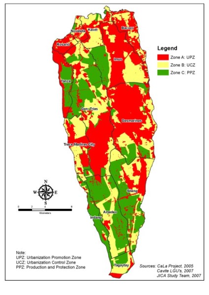
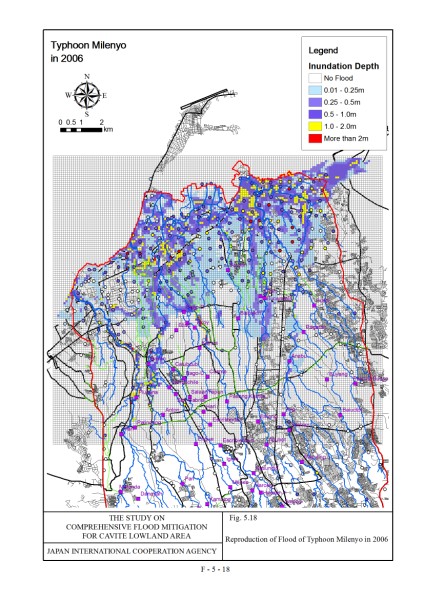
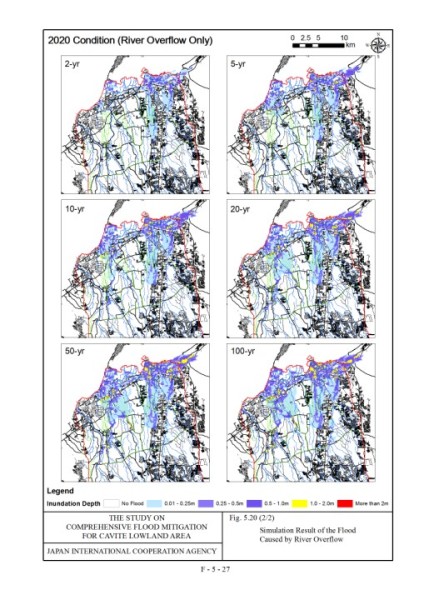
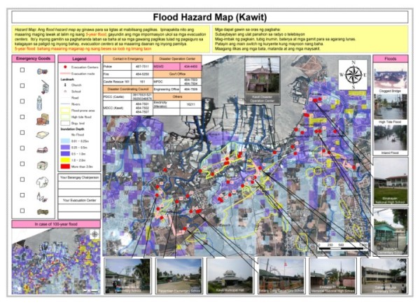
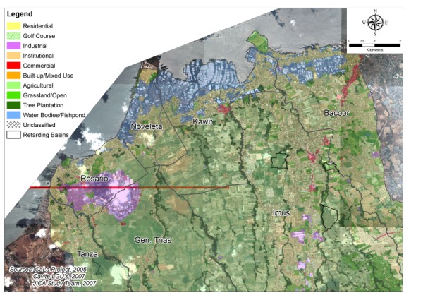
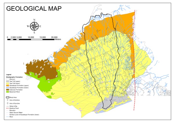
Sample Outputs:
|